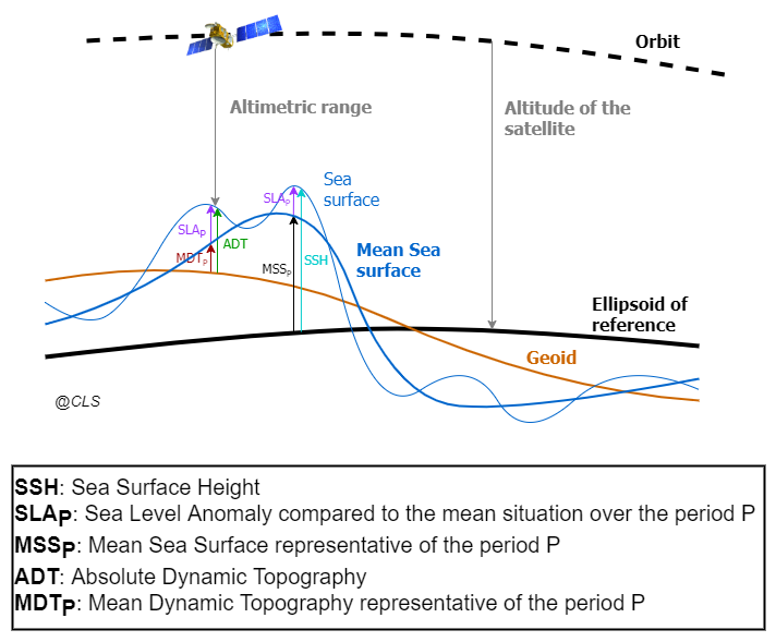
The Altimeter measurement allows to retrieve the SSH, i.e. the height from the reference ellipsoid to the instantaneous sea surface.
A MSS can be used to compute the SLA, i.e. the height between the mean state of the SSH (over a specific period N, see the altimeter reference period page) and the instantaneous sea surface:
SLAP = SSH – MSSP
A MDT field can be used to retrieve the ADT, i.e. the sea surface height above the Geoid:
ADT = SLAP + MDTP
The difference between the MSS and MDT is the Geoid:
MSSP = MDTP + Geoid