DUACS is the operationnal multimission production system of altimeter data developed by CNES/CLS. It features multimission products based on all altimetry satellites from GEOSAT to Jason-3 for a total of 100 years of cumulated data. In Near Real Time (NRT), the system’s primary objective is to provide operational applications with directly usable high quality altimeter data from all missions in operations. In Delayed Time (DT), it is to maintain a consistent and user-friendly altimeter data record using state-of-the-art recommendations from the altimetry community. This website presents the system and describes the different products available for the users.
Today, the DUACS production system is used for the operational production of sea level products for the Marine (CMS – Copernicus Marine Service) and Climate (C3S) services of the E.U. Copernicus program, for the processing of the Sentinel-3 products on behalf of EumetSat and for the production of demonstration and pre-operational products on behalf of the CNES french space agency (more details here).
Latest Maps
# This graphic is currently out of date. It will be update as soon as possible.
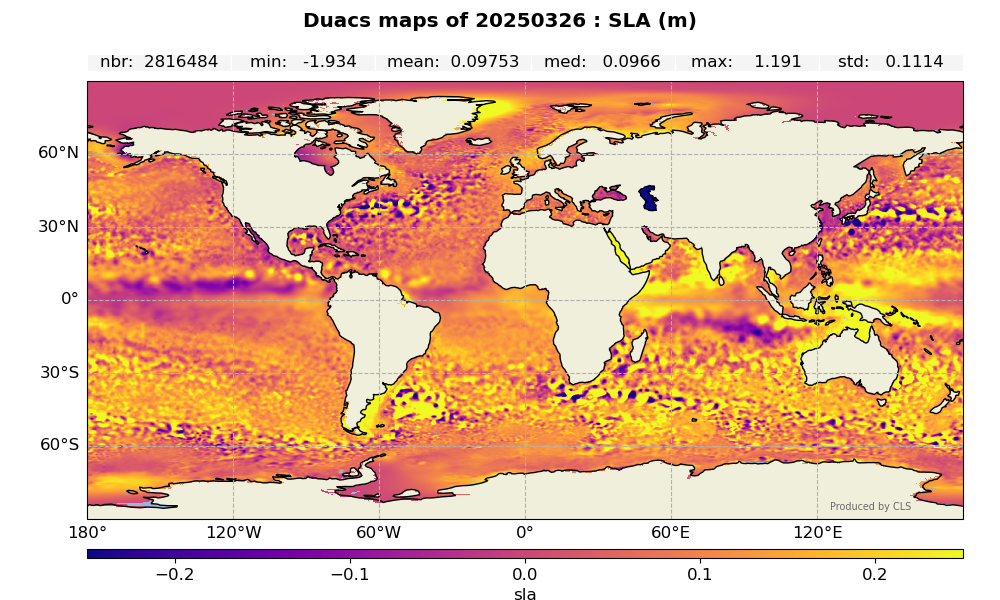
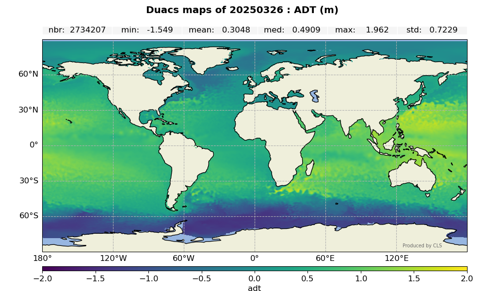
For more details of the different measures related to the sea surface height used in altimetry see the FAQ section